Use cases
Questions people bring to a model of a place, and a way through each.
Each page starts from a question as someone would ask it, splits it into the questions it really is, names the kind of model that answers each, the data it needs, what can be done without a model, and a next step. If you would rather be asked than read, So you want to make a digital twin? is five yes-or-no questions that end at the least effort that answers yours.
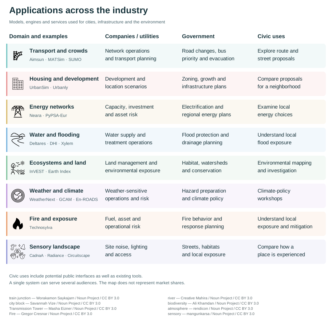
From the 2026 survey this wiki grew out of. A single system can serve several audiences; the map does not represent market shares.
Where will traffic go when a road closes or a lane is taken, and can signals or a timetable change keep buses on time?

Where did the oil go, what did it reach, is the sea recovering, and what would restoration or a different response have changed?

What happens when several proposals or policies are combined, and how can a group explore the trade-offs?
-
How will people move through a crowded place, and how long would it take to clear an area in an emergency?
As heating, driving and industry move to electricity, where will the network run short, and what mix of wires, storage and generation would close the gap?
-
Which areas will flood, how often, and what would changing a river, drain or pump do to the flooding?

If zoning or a transport investment changes, where will homes and jobs go, and who gains and loses?
-
Who lives here, what would a change do to their days, and how would they react to it, before anyone tries it on the real place?

If land changes use, farm to housing, forest to pasture, floodplain to park, what happens to water, habitat, carbon and food?

How do sound, light, smell and barriers shape a place for people and for other animals?

What weather is coming this week, and how will the climate of this place change over the coming decades?

Where might a fire spread from here, what is exposed, and where would clearing, burning or hardening give the most protection?