Water
River is the symbol; pastel blue is the colour.
stories
-
Water reaches one substation; water pumping and communications can go down with it.
-
Scrolling story and playable water-allocation model of the Colorado River basin by Anselm Hook; readers set the flow, choose the cut rule and retire irrigation, then share the future they built as a link.
tools
-
Open-source shallow-water solver from Geoscience Australia and the Australian National University for simulating floods, tsunamis and storm surge.
-
Open-source Python library by James Adams that computes drought, fire and flood-potential indices such as SPI, SPEI, the Palmer family and KBDI from station or gridded precipitation and temperature.
-
Open single-class fish detector built by Filippo Varini and a group of contributors, trained on seventeen open datasets pooled into one; finds fish in underwater images and video from any camera or habitat.
-
Open-source pipeline from EPFL's ECEO lab that turns handheld underwater video of coral reefs into labelled 3D point clouds, orthomosaics and benthic cover statistics.
-
Feature of Deltares' Delft-FEWS forecasting platform, from version 2026.02, that pulls Google Flood Hub river forecasts and flood status through Google's Flood Forecasting API so forecasters can compare them with their own models and observations.
-
Models coastal, estuarine and river systems, including water flow and related processes.
-
Combines water-system modeling with operational data, including wastewater treatment twins.
-
Molecular atlas that links microbial genes and transcripts from wetland and coastal sediments to field measurements of methane, nitrous oxide and sulfur, as evidence for blue-carbon projects; contacts are at Ecosphere Blue, whose MethaNet product is built on it.
-
Google's family of geospatial AI models and agents, covering satellite imagery, weather, floods and population, reached through Google Earth, Earth Engine, BigQuery, Maps Platform and Google Cloud.
-
Free public site from Google Research with riverine flood forecasts, flood maps and water trends for river basins in over 150 countries, updated daily; the same forecasts reach Search, Maps and Android and can be pulled by API.
-
Browser-based flood modelling platform that runs the open-source ANUGA solver in the cloud; users draw a model, run scenarios and compare the results with historic floods, free when the model is shared publicly.
-
AI weather model from Schmitt, Jain and co-authors that retrains ECMWF's AIFS on satellite precipitation observations to forecast rain more accurately at the local scale.
-
Ecosphere Blue's planned assessment service for blue-carbon projects, rating project performance with methane-risk projections drawn from microbial genomic evidence in mangrove sediment.
-
Free, open-source computational fluid dynamics software, maintained in two lines by OpenCFD Ltd and by the OpenFOAM Foundation; used for flow, turbulence, heat and multiphase problems across engineering and science.
-
Google Research's open-source hydrology framework, a Python package that replicates the LSTM river-flow models behind Flood Hub so forecasters can train or fine-tune them on their own watersheds.
-
Open-source, GIS-supported simulator by Martin Mergili and Shiva P. Pudasaini for rapid mass flows such as landslides, debris flows and glacial lake outburst floods, including chains of one process feeding the next.
-
Real-time underwater SLAM from the University of Michigan field robotics group that fuses learned stereo depth with IMU, pressure and Doppler velocity log measurements; developed and tested on shipwreck surveys.
-
Caribbean project testing whether dense restored stands of elkhorn coral reduce wave energy and sediment movement along coasts, with sites in Jamaica, Barbados and Antigua & Barbuda; funded by the Caribbean Biodiversity Fund.
-
Combines utility data and water-system modeling for network operations.
-
Robotic surface vehicle from Woods Hole Oceanographic Institution, built by Peter Traykovski and adapted for Anne Cohen's reef work, that photographs shallow coral reefs along GPS-tagged tracks so the same colonies can be checked again after each heat wave.
digital twins
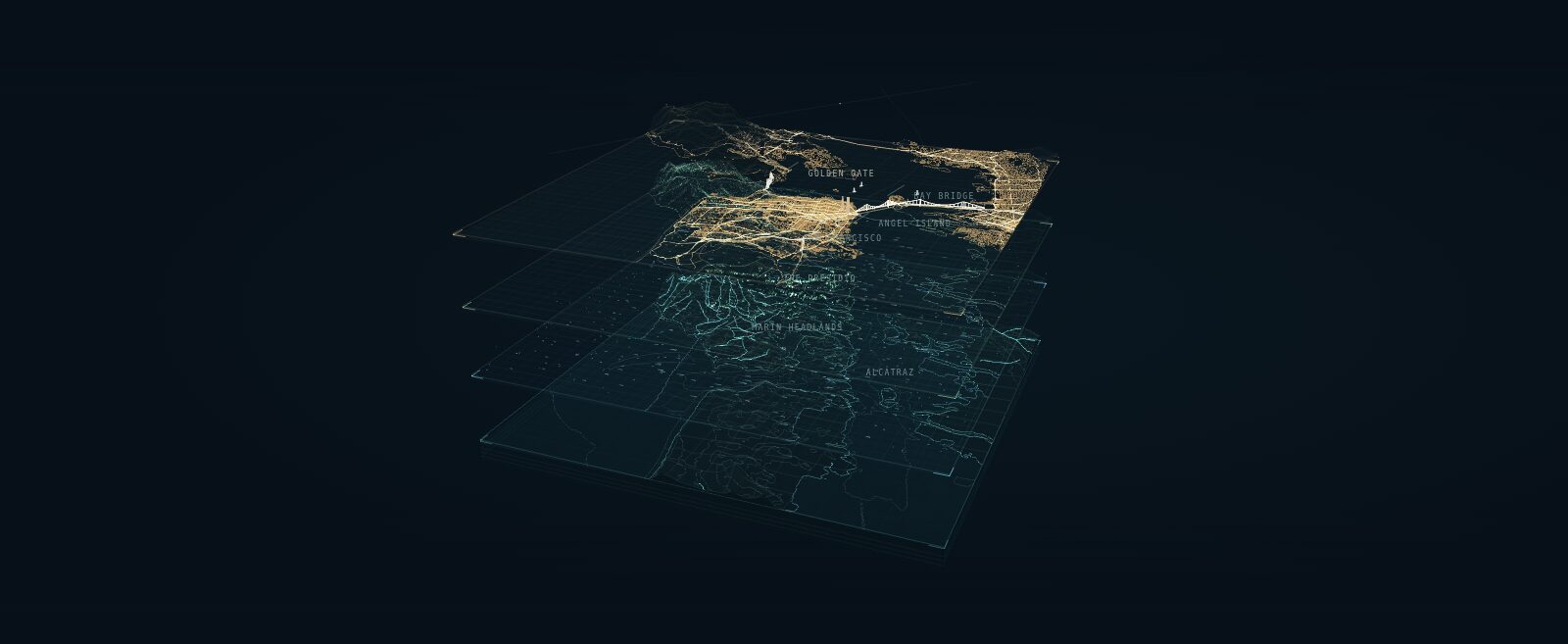
A layered portrait of San Francisco Bay that explains a digital twin as four shared geographic layers: earth and seabed, natural forces, living systems and the built world.
terms
-
The idea that a bioregion should be organised around the relationships that sustain life in a place, such as a shared water system, rather than around a boundary drawn on a map; argued by Indy Johar and related to the rights-of-nature movement for rivers.
-
Framework from the ecological design firm Biohabitats for asking, before a data center is designed, whether it belongs in a landscape at all, and how it relates to the watershed, habitat and community around it.
organizations
-
Coastal Assembly, a public benefit company out of MIT's Self-Assembly Lab, models how sand moves along a shoreline from satellite, wave, current and seabed data, then places engineered reef structures so that waves rebuild the beach.
-
Platform from Blue Green Future and Global Resilience Partners that helps governments count living nature as part of sovereign wealth; Tonga and Panama are its first partner countries.
questions
-
Which areas will flood, and how will changes to rivers, drainage or pumps affect them?
events
-
Scenario session at the Public Vitality Camp Berlin 2026, moderated by Dark Matter Labs, BiberAmt Berlin and nextlearning e.V., on governing the Berlin–Brandenburg water system across jurisdictions using measures from Berlin's Masterplan Wasser.
data sources
-
Stream, groundwater and other water observations.
Symbol: "river" by Creative Mahira, Noun Project, CC BY 3.0.