Living systems
Habitat is the symbol; pastel mint is the colour.
tools
-
The Amazon Conservation Team and the AARIMO network use Vantor satellite imagery to find and track illegal gold-mining dredges along the Puré River in the Colombian Amazon and pass the findings to enforcement agencies.
-
Open single-class fish detector built by Filippo Varini and a group of contributors, trained on seventeen open datasets pooled into one; finds fish in underwater images and video from any camera or habitat.
-
Open-source pipeline from EPFL's ECEO lab that turns handheld underwater video of coral reefs into labelled 3D point clouds, orthomosaics and benthic cover statistics.
-
Open object detector from the ConservationDronesAI group, built on RF-DETR, that finds people, mammals and vehicles in drone imagery for wildlife surveys and counts.
-
Molecular atlas that links microbial genes and transcripts from wetland and coastal sediments to field measurements of methane, nitrous oxide and sulfur, as evidence for blue-carbon projects; contacts are at Ecosphere Blue, whose MethaNet product is built on it.
-
Prototype web app by Hannah Nisonson of Esri's Applications Prototype Lab that links a 3D map of species observations in the San Bernardino National Forest with a 3D food-web graph, and shows what else is affected when a species is removed.
-
Pilot by The Nature Conservancy Argentina and the startup ReForest Latam that seeds native trees from drones on degraded farmland in Argentina's Gran Chaco.
-
Open-source detector from the Microsoft AI for Good Lab that finds wildlife in aerial and drone survey imagery; ships the OWL model family and extends MegaDetector from camera traps to overhead views.
-
Ecosphere Blue's planned assessment service for blue-carbon projects, rating project performance with methane-risk projections drawn from microbial genomic evidence in mangrove sediment.
-
Open-source family of wildlife detection models and tools from Microsoft's AI for Good Lab; MegaDetector finds animals, people and vehicles in camera-trap images, and PyTorch-Wildlife is the framework that runs it and its siblings for aerial and acoustic data.
-
Open-source, solar-powered edge device from Microsoft's AI for Good Lab that runs camera-trap and bioacoustic AI models on site and sends the results out by satellite or GSM, for biodiversity monitoring in remote places.
-
Caribbean project testing whether dense restored stands of elkhorn coral reduce wave energy and sediment movement along coasts, with sites in Jamaica, Barbados and Antigua & Barbuda; funded by the Caribbean Biodiversity Fund.
-
Wildflow's platform for coral reefs, where divers upload footage and get georeferenced 3D models, orthomosaics and bathymetry for tracking a reef over time, with the stated aim of a digital twin of any reef.
-
Robotic surface vehicle from Woods Hole Oceanographic Institution, built by Peter Traykovski and adapted for Anne Cohen's reef work, that photographs shallow coral reefs along GPS-tagged tracks so the same colonies can be checked again after each heat wave.
organizations
-
Multi-partner initiative, launching in 2026 with founding support from the Bezos Earth Fund, that combines field sensors, environmental DNA and satellite data with AI to report on biodiversity and ecosystem condition across the Amazon.
-
Coastal Assembly, a public benefit company out of MIT's Self-Assembly Lab, models how sand moves along a shoreline from satellite, wave, current and seabed data, then places engineered reef structures so that waves rebuild the beach.
-
Long-term monitoring network that resurveys permanent plots on European mountain summits; its 21 years of data underpin a 2026 Science study reporting rising local extinctions of alpine plants.
-
Platform from Blue Green Future and Global Resilience Partners that helps governments count living nature as part of sovereign wealth; Tonga and Panama are its first partner countries.
digital twins
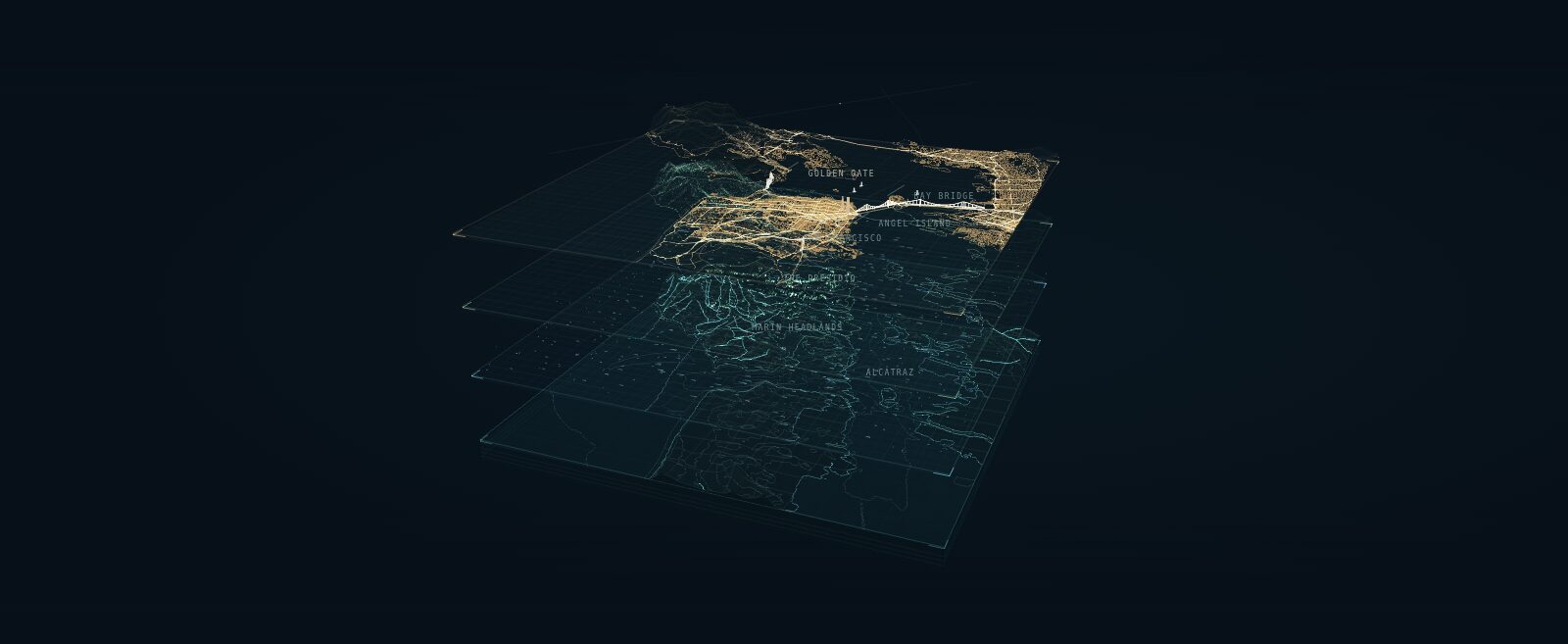
A layered portrait of San Francisco Bay that explains a digital twin as four shared geographic layers: earth and seabed, natural forces, living systems and the built world.
terms
-
The idea that a bioregion should be organised around the relationships that sustain life in a place, such as a shared water system, rather than around a boundary drawn on a map; argued by Indy Johar and related to the rights-of-nature movement for rivers.
-
The aim of predictive models of land, water, law and policy that ordinary people can run, question and argue with, rather than tools reserved for planners, companies and agencies.
-
A biodiversity-credit protocol from Ecosystem Regeneration Associates (ERA) in Brazil that pays landholders for keeping an umbrella species and its habitat in good condition, checked by monitoring and external audit.
-
A proposal for a foundation model trained on observations of the Earth itself, estimating the planet's current state and simulating how it responds to intervention.
-
Framework from the ecological design firm Biohabitats for asking, before a data center is designed, whether it belongs in a landscape at all, and how it relates to the watershed, habitat and community around it.
-
African Parks' unit of conservation performance, one square kilometre in which ecological integrity has been kept or improved over a year, used as the basis for outcomes-based funding.
-
A proposed social-science counterpart to Earth System Science, set out in The Anthropocene Crisis (Cambridge University Press), edited by Mathias Albert and Barry Buzan.
data sources
-
Densely annotated underwater image datasets of Red Sea coral reefs from EPFL and partners for training segmentation models; V2 adds panoptic labels, 95 classes and fish instances, and is the training data behind DeepReefMap.
-
Lidar-derived model from CTrees of forest fire fuels as one-metre voxels carrying canopy, ladder and ground fuel properties, demonstrated at three US sites and published as open 3D arrays for fire models to read.
-
Global map from One Earth and Nature Data Lab of lands and inland waters important for biodiversity, ecosystem services and climate, with land cover and conservation status, designed to be updated every year; launched September 2026 as a free web viewer.
-
Community platform where people photograph plants, animals and fungi and others identify them; the observations are published as open biodiversity data for research and conservation.
-
Esri feature service in ArcGIS Living Atlas that serves iNaturalist's research-grade observations worldwide, refreshed monthly, with hexagon summaries at small scales.
-
Map and dataset from Cornell researchers of about 1.8 million individual tree crowns in New York City classified to genus from PlanetScope satellite imagery and airborne lidar, including trees on private land and in natural areas; published August 2026.
-
Web map of orca and other whale sightings in the Salish Sea, placed on the map from the narrative reports in Orca Network newsletters.
-
Web map from WWF and partners of whale migration routes built from pooled satellite telemetry, with threat and protection layers alongside; free to browse at bluecorridors.org.
events
-
Call for papers from Leonardo/ISAST for a focus section of the journal Leonardo on art, science and technology work about climate, environmental justice and ecological repair; manuscripts due 15 December 2026.
-
Scenario session at the Public Vitality Camp Berlin 2026, moderated by Dark Matter Labs, BiberAmt Berlin and nextlearning e.V., on governing the Berlin–Brandenburg water system across jurisdictions using measures from Berlin's Masterplan Wasser.
Symbol: "biodiversity" by Ali Khamdan, Noun Project, CC BY 3.0.