
People & society
People at a table is the symbol; pastel rose is the colour.
tools
-
The Amazon Conservation Team and the AARIMO network use Vantor satellite imagery to find and track illegal gold-mining dredges along the Puré River in the Colombian Amazon and pass the findings to enforcement agencies.
-
Knowledge graph of urban climate adaptation plans from the Urban Tech Hub at Cornell Tech; AI agents read city plans and extract actions, hazards, outcomes and costs, each traced to its source sentence.
-
Agent-based, discrete-event and system-dynamics modeling; pedestrian and transport libraries.
-
Open-source Android app from the non-profit Awana Digital for territory monitoring and mapping, co-designed with Indigenous communities; teams record observations on a map and share them peer to peer.
-
Explores combinations of climate policies and their modeled effects.
-
Spatial agent-based models for urban mobility, evacuation, environmental and other applications.
-
Organizes spatial proposals, alternatives and stakeholder negotiation.
-
Google's family of geospatial AI models and agents, covering satellite imagery, weather, floods and population, reached through Google Earth, Earth Engine, BigQuery, Maps Platform and Google Cloud.
-
Experimental Gemini-based agent from Google Research that plans a multi-step spatial analysis, calls Earth AI models and geospatial data sources, and returns the result with its plan and sources shown.
-
Part of Google Earth AI; given a user's local outcome data such as disease rates or crop yields, it picks relevant population and satellite signals and trains models for spatial prediction, downscaling and forecasting.
-
Google Research geospatial foundation model that turns aggregated search trends, place busyness, maps, weather and air quality into an embedding vector per postal code or county, for predicting local health, economic and environmental indicators.
books
A practical primer from Crooks, Malleson, Manley and Heppenstall, 2019, on building agent-based models of people in places and linking them to GIS, with worked examples in NetLogo.
Edited volume from Heppenstall, Crooks, See and Batty, 2012, collecting the foundations, methods and applications of agent-based modelling of geographic systems.
-
Epstein and Axtell's 1996 Sugarscape experiments, which showed how migration, inequality, trade and conflict can grow from simple agents on a landscape; the founding book of agent-based social simulation.
James C. Scott's 1998 study of why large schemes to reorder nature and society from above have failed, and of the local knowledge their simplified maps leave out.
-
The 1972 Club of Rome report by Meadows, Meadows, Randers and Behrens that used the World3 system-dynamics model to ask whether exponential growth in population and industry could continue on a finite planet.
Michael Batty's 2013 argument that cities are flows and networks rather than fixed artefacts, with the models that follow from treating them that way.
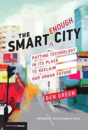
Ben Green's 2019 argument that cities should use technology as a tool for democratic and equitable ends rather than treat it as the goal, with cases of smart-city projects gone wrong and alternatives.
-
Jay Forrester's 1969 system-dynamics model of a city as feedback loops among population, housing and industry, the first computer model to simulate a whole city's life cycle.

Jay Forrester's 1971 system-dynamics model of the world as one system of population, capital, food, resources and pollution; the model behind The Limits to Growth.
terms
-
The idea that a bioregion should be organised around the relationships that sustain life in a place, such as a shared water system, rather than around a boundary drawn on a map; argued by Indy Johar and related to the rights-of-nature movement for rivers.
-
The aim of predictive models of land, water, law and policy that ordinary people can run, question and argue with, rather than tools reserved for planners, companies and agencies.
-
A proposed social-science counterpart to Earth System Science, set out in The Anthropocene Crisis (Cambridge University Press), edited by Mathias Albert and Barry Buzan.
questions
-
How will people move through a station or leave an area during an emergency?
-
What changes when we combine different climate policies or land-use proposals?
data sources
-
Community platform where people photograph plants, animals and fungi and others identify them; the observations are published as open biodiversity data for research and conservation.
events
-
Scenario session at the Public Vitality Camp Berlin 2026, moderated by Dark Matter Labs, BiberAmt Berlin and nextlearning e.V., on governing the Berlin–Brandenburg water system across jurisdictions using measures from Berlin's Masterplan Wasser.
organizations
-
Partnership of Commonland, Ashoka, The Weaving Lab and Wire Group, formed in March 2025 within the Bioregional Weaving Labs Collective, that is prototyping Bioregional Financing Facilities in three European bioregions and publishing discovery-arc papers on how such facilities should work.
stories
-
Scrolling story and playable water-allocation model of the Colorado River basin by Anselm Hook; readers set the flow, choose the cut rule and retire irrigation, then share the future they built as a link.
Symbol: "Meeting" by Creative Stall, Noun Project, CC BY 3.0.