article · draft
Twelve places with a question for a model
Twelve recent reports about places, each read for the question someone there would put to a model, and for the kind of model that question needs.
WaterLiving systemsWeather & climateFood & landEnergy
News about places arrives faster than anyone can model. The reports below were saved over one summer because each made someone want to build a model, and then they sat unread. Each is read here for one thing: the question a person in that place would put to a model, and the kind of model that would answer the question. The facts are the reports'. The question and the model are ours, and are marked as such.
The twelve sort by size: single places first, then basins, seas and a strait, then the planet's trade and climate. Size decides what the model has to hold and who could build it, so the list runs small to large.
One place
A town in Colorado with no one to run the water. Hartman is a town of under sixty people in Colorado's south-east. On 29 July 2026 the secretary of state's office announced that it had been declared abandoned.2 Every elected official had resigned, and there was no board and no clerk. A resident had written that the water had gone without chlorine for over a month and smelled. Residents had been told to boil it for months.2 The fifteen-page order called abandonment the only legal route to clean water. The treatment plant and tower pass to Prowers County.2 The Denver Post reported that the quarrelling was intense enough to keep away any operator who might have helped.2 The question: if a town loses its operator and its board, how long until the water is unsafe? What does it cost the county to take the system over, compared with repairing it now? The model: a small-utility model of one town's tank, treatment, dosing records and repair backlog, with the governance state as an input. No engine on the shelves does this. It is a spreadsheet joined to the state's drinking-water compliance records.
A lagoon in Portland that turns toxic. Ross Island, in the Willamette River, is artificial. In 1926 the Army Corps of Engineers walled off a cluster of islands into one. From 1926 to 2001 a gravel company dug the inside out to about 120 feet.5 The lagoon left behind grows cyanobacteria, blue-green algae that close the river to swimmers. The Willamette has had significant blooms in four of the last five years.5 On 25 June 2026 a team from Oregon State University presented two fixes, led by Desirée Tullos, to about a hundred people.5 One opens the lagoon's south-west wall so the river runs through. The other does that and adds a second channel on the north-west. The cost is put at about $17 million or $27 million.5 Either is meant to flush the lagoon faster than its water warms and the bacteria multiply.5 The question: does one channel flush faster than the water warms, or does it take two? The model: a hydrodynamic and water-quality model of the lagoon and its reach. The team ran one,5 and Delft3D is an engine built for the job. It needs the pit's bathymetry (the shape of its bottom), river discharge and temperature, nutrients, and past bloom records.
A salmon pen in a Chilean fjord with no cable to shore. Mowi's Huar Norte pen in the Los Lagos region ran a diesel generator day and night for feeders, lights, cameras, oxygen sensors and pumps.10 Panels on pontoons now ring the cages and charge a battery bank. A controller runs the generator only for what sun and storage cannot cover.10 The page puts solar and battery at about 57 percent of the site's annual power, and the diesel avoided at roughly 36,750 gallons a year.10 Fewer boats now carry fuel out, and no fish gathered under the panels. The page's figures come from two industry links, and its lead image is labelled as generated by AI.10 The question: for this pen in this fjord, how much of the year-round load can sun and batteries carry? How many hours a year does the generator still run? The model: an hourly energy balance of one site, setting local irradiance (sunlight reaching the panels) against the pen's metered load, battery size and the generator's fuel curve. Any energy-system tool does this. The hard part is a year of local weather.
A ranch in Montana, thirty-seven years after the cattle left. In 1989 Ted Turner bought the Flying D, between the Gallatin and Madison rivers south of Bozeman. He took off the cattle, tore out hundreds of miles of interior fence and brought in bison.6 Under cattle the ranch had run 7,000 to 8,000 head, and some creek bottoms had been grazed to mud.6 Turner later called the fence removal an early mistake. The herd grazed some ground too hard and other ground too little, and some fencing went back.6 The Turner Institute of Ecoagriculture says the ranch now carries about 4,500 bison and has returned over 5,000 acres of cropland to grazing.6 The column's evidence that the swap matters comes from elsewhere: a 29-year comparison at Konza Prairie in Kansas, and a Montana stream study. Its authors say one site's results do not settle how one ranch performs.6 The question: if a ranch goes from cattle to bison and the interior fences come out, where does the herd overgraze and undergraze? How do the creek bottoms change over decades? The model: a rangeland model of one property. Herd movement relative to water and fence is set against vegetation and drought, and checked against riparian (streamside) plots over time.
Pine hills in Israel that were planted to be green. A Times of India desk piece cites a study published by the Society for the Protection of Nature in Israel. A century of planting changed open shrubland, grassland and the loess plains of the south into dense pine, mostly Aleppo pine.8 The plantations may have replaced habitats with their own specialised plants and animals.8 Dense pines shade out plants that need sun. The acid needle layer can stop native seed, and pine roots draw down scarce water and dry springs.8 After a run of bad fires, including the 2021 fire in the Jerusalem hills, the national forestry fund no longer plants pines in natural batha (low Mediterranean scrub) and grassland. It now removes dense canopy and seedlings and regrows native oak, carob and terebinth.8 The question: if the pines on this hillside are thinned, how much of the open ground and its lizards and birds comes back? Does the spring below recover, and does the fire risk to the village go down? The model: three coupled models, of land cover and habitat, water balance and fire spread, run over scenarios of removal. The data are plantation-age maps, spring records, species surveys and fire history. The chain belongs on the site's ecosystems and land question page.
A basin, a sea, a strait
Mussels dying in the rivers of the American South, and no one knows why. North America has about 300 documented freshwater mussel species. Roughly one in ten is gone, and a third of the rest are listed.1 The losses went on after the obvious causes eased. Dam building had largely ended by the mid-1980s and the rivers were cleaner under the Clean Water Act, yet most populations kept falling.1 Wendell Haag of the U.S. Forest Service watched Horse Lick Creek in Kentucky lose its mussels from the 1990s. The loss was mostly complete by 2005.1 In 2018 he caged captive-reared juveniles at seventeen sites in the Rockcastle River. Growth was poor at some sites, and slower in cold water. Mine contamination showed little sign. The strongest correlation was with the density of the invasive Asian clam.1 His $1.3-million follow-up put juveniles in about ninety streams in thirteen states over three summers, with algae, sediment, chemistry, fish and insect data alongside. He is still working through it and warns it may not be conclusive.1 So far, he says, the clam is the one factor present in most declining streams. Meanwhile hatcheries in Alabama and Kentucky breed and release rare species, and a 2024 federal grant of $3.4 million is to recover six of them.1 The question: in this creek, is it the clams, the sediment, the runoff or something else that stops young mussels growing? If hatchery mussels are planted here, will they live long enough to breed? The model: a stream-reach model linking food, clam density, temperature, sediment and host fish (the fish that mussel larvae ride on) to juvenile survival, so a basin can rank reaches for reintroduction. Haag's ninety streams are the calibration set such a model needs and does not yet have.
A town on the Rio Grande that must give water back to Texas. In 2013 Texas sued New Mexico at the Supreme Court over groundwater wells that, it said, took river water owed under the 1938 compact. A settlement among the three states and the federal government was approved this May.3 New Mexico has until May 2036 to pump 18,200 acre-feet a year less from wells between Caballo Reservoir and the state line. An acre-foot covers an acre of land a foot deep.3 The cut is about 6 to 7 percent of the groundwater used there, and the river will be gauged at the line for the first time.3 The state's first move is $150 million to buy groundwater rights from farmers, retire them and let the land go fallow. Officials are weighing a cap on sales around Hatch, whose vegetable growers are more exposed than the pecan orchards of the Mesilla Valley.3 If the buy-back falls short, cuts come by priority, newest users first, or by a plan now in confidential mediation.3 Snowmelt supply in the basin is down 17 percent since 2000. Elephant Butte Reservoir fell to 3 percent after the spring release. At Santa Teresa a 2.5-gigawatt data centre is being built on rights now used by a sod farm.3 The question: which wells, in which valley, so that the river at the Texas line meets the decree every year to 2036 without hollowing out Hatch? The model: a coupled surface and groundwater model of the reach, with pumping by well, demand by crop and return flows, under warming. The sibling basin to the west has a playable version on this site, Who Drinks the River?.
The Great Lakes, refilled once by glaciers. An Earth.com explainer reports a study in JAWRA without naming it. Its case is that the lakes' refill rate matters more than their size.4 Meltwater filled the five basins about 10,000 years ago. Precipitation, runoff and groundwater now add under one percent of the volume in a year, and the St. Lawrence takes away about as little. Hydrologists therefore treat the lakes as non-renewable on a human timescale, and pollutants stay for decades.4 Industry, power plants, farms and cities take roughly 44 billion gallons a day, most of it returned.4 Ice is the second lever. In NOAA records since 1973, peak winter cover has been falling around five percent a decade, and winter 2024 set a record low near 4 percent.4 Open water in midwinter evaporates, lowers levels and feeds heavier lake-effect snow. Whitefish lose the ice over their eggs. Farm phosphorus feeds the Lake Erie blooms. In August 2014 one shut off drinking water for about 500,000 people around Toledo. Some 40 million people drink from the lakes.4 The question: at 44 billion gallons a day, with shrinking ice and rising evaporation, what happens to lake level, intake quality and the whitefish over fifty years? Which withdrawals or phosphorus loads would have to change to hold the line? The model: a basin water balance coupled to lake hydrodynamics, ice and water quality. Running it is research-institute work. The data are the NOAA ice record and the tributary nutrient loads.
A fly that eats living flesh, and the cattle it would stop moving. The New World screwworm is a fly. The female lays eggs in any open wound or natural opening, and the maggots eat only living tissue.15 The Meat Institute's briefing to packers sets out what follows a detection in the United States. It must be reported at once to state animal health officials and the federal area veterinarian.15 Infested animals are quarantined where they stand, and fly traps go out to find the spread. Neighbouring states may stop animal movements from an affected state until surveillance shows the fly would not travel.15 The fly was eradicated from the United States in 1966, and a small Florida Keys outbreak was ended in 2017. Both were done by releasing sterile males, since a female mates only once.15 The question: if the fly turns up on a ranch in this county, how far and how fast does it spread through cattle and wildlife? Where do the traps and sterile releases go, and which movement routes get shut? The model: a spread model of the fly, driven by temperature and host density and coupled to the livestock movement network. Sterile-insect programmes plan with this kind of model. A county needs the premises and movement records to run it locally.
Parkland in Argentina and Chile, handed back with a 99-year clause. Kris Tompkins ran the clothing company Patagonia and left it in 1993. She and her late husband Doug Tompkins spent roughly thirty years buying worn-out ranch, forest and wetland in the two countries. They repaired it and gave nearly all of it to the governments as parkland.7 The page puts the spending at more than $345 million. The Argentine gift came with conditions: national parks, open to the public, protected for at least 99 years.7 On the Chilean properties, fences had cut the grassland into paddocks for a century, and repair meant pulling about 700 kilometres of barbed wire. In the Iberá wetlands it meant returning jaguars after seventy years without them.7 The page's acreage figures do not agree with each other.7 The question: with the fences out and the jaguars back, how fast is the grassland recovering across the donated parks and the provincial land next door? Where should the next reintroduction or fence removal go to join the pieces into one landscape? The model: land cover from satellite over the old paddocks, a connectivity model (how easily animals move between patches) of the kind Circuitscape runs, and collar and camera-trap data for the cats.
Ships idle in the Gulf, growing a coat. Open hostilities between the United States and Iran began on 28 February 2026, and the Strait of Hormuz has been held shut since.11,12 The Times of India reported a study in Biological Invasions by 24 marine scientists, led by the University of Maryland Center for Environmental Science.11 The newspaper gives estimates of about 1,500 vessels stuck in the Persian Gulf and several hundred more in the Gulf of Oman.11 Hulls at anchor for months grow slime, then weed, barnacles and shellfish, in the season when Gulf organisms grow fastest. The authors warn that when the ships move again, that growth could seed ports worldwide.11 The International Maritime Organization says a ship idle more than thirty days needs its fouling (the growth on its hull) dealt with before sailing. Divers are being sent to Gulf ports to scrape hulls, and the fee per vessel could rise by as much as 60 percent, to around $8,000.11 The question: when the strait opens, which of these ships carry the heaviest fouling, and which ports do they reach first? Which hulls should the divers clean before they leave? The model: a vessel-level model. Anchorage dwell time from ship-tracking data, set against water temperature, estimates fouling per hull. Each ship is routed to its likely next port, and each port is scored for climate match with the Gulf's species.
Trade and the planet
The same strait, seen from a rice field in Bangladesh and an oil port in Saudi Arabia. NASA Harvest's Harvest2Market is an open web tool presented in May 2026. It brings together what food-security analysts otherwise find scattered: satellite crop condition, the monthly GEOGLAM Crop Monitor, trade figures, shipping and food-security assessments.13 Its worked example is Bangladesh, which grows about 7 percent of the world's rice and gets much of its fertiliser by sea through Hormuz. The tool flags the closure as a risk to the coming rice crop.13 On 14 September 2026 DW reported that the Houthis had taken the Hanish islands, a week after seizing Mayun Island and the port of Mokha.12 That closed the Bab el-Mandab route, which Saudi Arabia had turned to when Hormuz shut. Saudi crude now reaches Asia only by Suez or around the Cape.12 The question: a strait closes. How far does the shock travel: through fertiliser into next year's harvest, through insurance and routing into the price of fuel, through a hull into a harbour on the other side of the world? The model: no single one. Harvest2Market is a trade-network and crop-condition view. The routing question wants a chokepoint model over ship-tracking and port capacity. The invasion question is the one above. At this size questions generally hand off from one model to the next. This site therefore has a data shelf and an ontologies shelf as well as engines. A tool like DSSAT answers the crop end, and GCAM belongs at the trade and energy end.
Tropical forests nearing the temperature where leaves stop working. Above a critical temperature, leaves can no longer photosynthesise. A study in PNAS by Nina van Tiel and colleagues, read here from its abstract, followed the margin between that threshold and the hottest canopy temperature for 208 tropical tree species from 2001 to 2020. It used satellite surface temperature and species range maps in South America, Southeast Asia and Central Africa.14 The mean critical temperature was 46.1 degrees. The margin fell consistently, by 0.4 degrees a decade on average and 0.5 in South America.14 Over the twenty years, the area whose canopies exceeded the mean threshold grew from 43 to 57 million hectares. Earth system model projections under medium-to-high emissions put that area at possibly 83 million hectares by 2050 and 160 million by 2100.14 The question: which stands in this forest, and which species in them, cross the threshold in the next heat wave, and in the 2040s? The model: the study's own, a gridded overlay of canopy temperature on range maps with per-species tolerances. Anyone with the satellite record and a tolerance table can rerun it for one forest. It is the only item on this list whose model exists and is published.
What the list says
The lagoon, the forest and the trade view already have their model: somebody built it and published. The ranch, the parks, the fly and the river have a known kind of model and no local data to feed it. That is the ordinary condition of a place that wants to know something about itself. The mussels, the lakes, the salmon pen and the abandoned town need measuring first. A model built before the measuring would only be a tidier way of guessing. That leaves the strait. Its questions form a chain and fall on the seams between models, and the work is in the hand-offs. A crop model does not know what an underwriter charges. A routing model does not know what a barnacle does in a northern harbour. The guides cover those hand-offs. The use cases are where each of these questions belongs once someone writes it down.
- tier
- 3
is about this entity
-
Which areas will flood, how often, and what would changing a river, drain or pump do to the flooding?
-
If land changes use, farm to housing, forest to pasture, floodplain to park, what happens to water, habitat, carbon and food?
refers to this entry as a source
-
Scrolling story and playable water-allocation model of the Colorado River basin by Anselm Hook, in which readers set the flow, choose the cut rule, retire irrigation and share the result as a link.
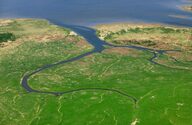
Deltares' Delft3D FM Suite models water flow, transport of matter and morphology in coastal, estuarine and river environments.
-
Open-source program that borrows algorithms from electronic circuit theory to predict how animals, plants and genes move across a landscape, treating every possible path at once; written in Julia.
open sourceopen participation
-
DSSAT (Decision Support System for Agrotechnology Transfer) simulates crop growth, development and yield from daily weather, soil and management data, with models for over 45 crops; free to download.
-
Global Change Analysis Model from the Joint Global Change Research Institute; links energy, water, agriculture and land, the economy and climate in long-run global scenarios.
open sourceopen participation
Tags: issues, questions, scale, water, ecology, trade, examples