tool · draft
GeoLibre
Free, open-source GIS from the opengeos project that loads, styles and analyses geospatial data in a web browser, as a desktop or phone app, or inside a Jupyter notebook, keeping the data on the user's own machine.
What is reusable: open sourceunknown dataAPIopen participation MITPlugin API, Python and R packages, and a server API are documented; the GitHub repository takes contributions.
The citation the project asks for names Q. Wu as its author. One workspace runs in several places:
- a web browser
- a native desktop app on Windows, macOS and Linux
- Android and iOS apps
- Jupyter notebooks, through a Python package
There is also an R package. GeoLibre is built on MapLibre GL JS, deck.gl, DuckDB-WASM Spatial, Tauri, React and TypeScript. A project can be drawn by any of four rendering engines. MapLibre GL JS is the default; the others are Mapbox GL JS, CesiumJS and the ArcGIS Maps SDK. Engines can be mixed in synchronised split panes.
Layers come from local files, web services, cloud-native formats, 3D Tiles, LiDAR, Gaussian splats, and DuckDB or PostgreSQL databases. LiDAR is laser scanning that records surfaces as points; a Gaussian splat captures a 3D scene as many small soft coloured blobs. The web services are XYZ, WMS, WFS, WMTS, ArcGIS and STAC. The cloud-native formats are GeoParquet, FlatGeobuf, PMTiles, Zarr and COG.
A toolbox of more than a thousand geoprocessing tools runs in the browser on WebAssembly. The tools cover vector, raster, remote sensing, hydrology, terrain, LiDAR, network and projection work. No server is involved, so data stays on the user's machine. Other features are a SQL workspace for DuckDB Spatial, a time slider, a story-map builder, field collection by GPS, multi-user collaboration, and sharing or embedding of projects.
Demos include Manhattan building footprints extruded by construction year with the subway on top, and basemaps of the Moon, Mars and other bodies. A gallery lists 105 projects built from public open data, on themes such as natural hazards, climate, water, transport and cities.
GeoLibre is released under the MIT licence at no cost. The web version needs no installation, and installers and app-store builds cover desktop and mobile. The maker calls the project stable and in active development with regular releases, says it will stay free, and asks for sponsorship.
- form
- open-source application
- group
- 3D cities and mapping
- homepage
- https://geolibre.app/
- licence
- MIT
- cost
- free
uses this engine, platform or technique

Open-source map libraries from the MapLibre organization: GL JS for GPU-accelerated vector-tile maps in a web page, Native for mobile, desktop and embedded apps, plus a style specification, a tile format and the Martin tile server.
open sourceAPIopen participation
-
GPU-powered framework for visual exploration of large datasets in the browser, built by composing layers; draws over base maps from MapLibre, Mapbox, Google Maps and ArcGIS.
open sourceAPIopen participation
-
Open-source JavaScript library from Cesium for 3D globes and maps in the browser; streams 3D Tiles, terrain, imagery and time-dynamic data on a WGS84 globe.
open sourceAPIopen participation
does a similar job
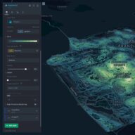
Open-source geospatial analysis tool for large datasets that runs in a browser: load a file, add layers, filter and animate over time, without writing code.
open sourceopen participation
Tags: gis, web, maps, open source, geoprocessing, desktop